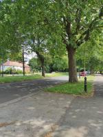
| wadi en bermfiltratie bij project Forum - Zuid |
24 Apr 2024 |
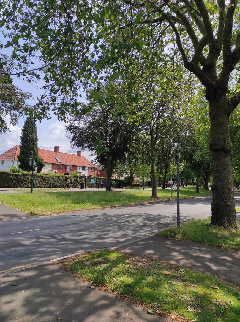
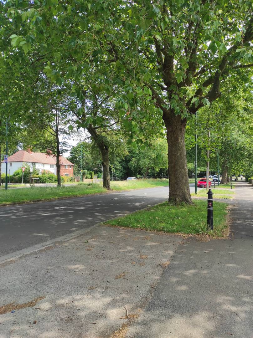
| wadi en bermfiltratie bij project Forum - Noord |
23 Apr 2024 |
| MCWD Detention Basin - Family Park, Cebu City |
14 Apr 2024 |
| Bermfiltratie kolkloze weg Veldlaan |
12 Apr 2024 |
| Bermfiltratie Peppelveld - afvoer weg op 1 oor |
09 Apr 2024 |
| Bermfiltratie Haverveld - afvoer weg op 1 oor |
09 Apr 2024 |
| Bermfiltratie Koolveld - afvoer weg op 1 oor |
09 Apr 2024 |
| Bermfiltratie Maisveld - afvoer weg op 1 oor |
09 Apr 2024 |
| Bermfiltratie Zandstraat |
08 Apr 2024 |
| Bermfiltratie fietspad Palkerdijk |
31 Mar 2024 |
| Poldertuin |
29 Mar 2024 |
| Climate Adaptative Roadside verges and water retention A2, The Netherlands |
29 Mar 2024 |
| Bermfiltratie met vloeiveld III - parkeerplaats fallonhotel |
29 Mar 2024 |
| Bermfiltratie parkeerplaats II - Fallon hotel: berm is teh hoog |
29 Mar 2024 |
| Bermfiltratie parkeerplaats I: berm is te hoog |
29 Mar 2024 |
| Geveltuinen laan op zuid Rotterdam |
28 Mar 2024 |
| Utrechtseweg is afgekoppeld naar berm |
27 Mar 2024 |
| Bermfiltratie Lefershoek, Den Ham |
24 Mar 2024 |
| Steenbreek en bermfiltratie van de Veldelaan |
19 Mar 2024 |
| Landje |
15 Mar 2024 |
| Aanplant 50 nieuwe bomen |
14 Mar 2024 |
| Vanishing Staircase in het Zocherpark (2018) (ecologische trap Centraal museum Utrecht) |
11 Mar 2024 |
| Bermfiltratie Michelangelostraat II |
07 Mar 2024 |
| Norkis Cyber Park - Mandaue City, Cebu |
07 Mar 2024 |
| Bermfiltratie Michelangelostraat I |
06 Mar 2024 |
| Green Façade (flowers) along Mahiga River - Mandaue City, Cebu |
28 Feb 2024 |
| Water retentie amstelveen |
26 Feb 2024 |
| Berm A2 Abcoude |
25 Feb 2024 |
| Retentie beide zijden tankstation |
25 Feb 2024 |
| Groen dak 2 Reindersmeer bio diversiteit |
25 Feb 2024 |
| Cut Trees & Dead Grass |
22 Feb 2024 |
| Newcastle Circus |
19 Feb 2024 |
| Lincoln Circus |
19 Feb 2024 |
| Bermfiltratie Porrenhofstraat |
14 Feb 2024 |
| Geveltuin |
13 Feb 2024 |
| Bermfiltratie Pijlpuntstraat, Nijmegen (2000) |
12 Feb 2024 |
| Reconstructie Valkhofkwartier, deel Kelfkensbos 2024 - xxxx |
12 Feb 2024 |
| Tree |
12 Feb 2024 |
| stormwater infiltration road verges N310 |
10 Feb 2024 |
| Organically-grown Crops |
01 Feb 2024 |
| Numerous Trees Species |
01 Feb 2024 |
| SEKEM Greenery |
01 Feb 2024 |
| Indoor Plants |
30 Jan 2024 |
| Vast Biodiversity. |
30 Jan 2024 |
| Abandoned area in Al Obour |
30 Jan 2024 |
| Desert areas |
29 Jan 2024 |
| Trees at FACU |
29 Jan 2024 |
| Climate adaptieve road verges parking area funeral home waalstede |
29 Jan 2024 |
| Desert |
29 Jan 2024 |
| Petunia. |
29 Jan 2024 |
| Ornamental Plants. |
29 Jan 2024 |
| Biodiversity in AUC’s Plants. |
29 Jan 2024 |
| Planting Full Gardens in AUC. |
29 Jan 2024 |
| Crow and plastic bags |
28 Jan 2024 |
| Polluting planted areas |
28 Jan 2024 |
| Oldest Tree in Zamalek |
28 Jan 2024 |
| Plant & Flower Park |
28 Jan 2024 |
| Polluting plants |
28 Jan 2024 |
| Bermfiltratie Dovenetel en Pinksterbloem |
23 Jan 2024 |
| Bermfiltratie Herderstasje |
23 Jan 2024 |
| Bermfiltratie Fluitekruid |
23 Jan 2024 |
| Bermfiltratie Hondsdraf I |
23 Jan 2024 |
| Bermfiltratie Hondsdraf en Olieslager |
23 Jan 2024 |
| Bermfiltratie Herderstasje & Hondsdraf (2010-2012) |
23 Jan 2024 |
| Beuningen groen |
20 Jan 2024 |
| Bermfiltratie Pinksterbloemstraat Rijssen |
15 Jan 2024 |
| Waterberging A10 Amsterdam |
07 Jan 2024 |
| Green roadside verges Henriette Roland Holstlaan Almelo |
05 Jan 2024 |
| Bermfiltratie/wadi Nieuwe Heinoseweg N35 thv Wijthmen |
04 Jan 2024 |
| Wadi/bermfiltratie N38 tussen Raalte en Nijverdal |
04 Jan 2024 |
| Bermfiltratie Almelose weg N35 |
04 Jan 2024 |
| Bermfiltratie A35 thv Wierden |
04 Jan 2024 |
| Waterretentie A1 thv Borne |
04 Jan 2024 |
| Bermfiltratie Deurningerstraat Hengelo |
04 Jan 2024 |
| Bermfiltratie Beneluxbaan Hengelo |
04 Jan 2024 |
| Bermfiltratie N342 Oldenzaal |
04 Jan 2024 |
| Vispassage Lateraalkanaal Almelo |
04 Jan 2024 |
| Ecoduct Twilhaar bij Nijverdal N35, The Netherlands |
04 Jan 2024 |
| Berm(in)filtratie Burgemeester Zuidwijklaan Raalte |
04 Jan 2024 |
| Bermfiltratie Zwolseweg N35 (tpv Heino) Voor heino |
04 Jan 2024 |
| Green roadside verges Zwolseweg N35 Hoornhorst The Netherlands |
04 Jan 2024 |
| Everglades National Park USA |
31 Dec 2023 |
| Turtles at Fort Lauderdale Beach Miami, USA |
31 Dec 2023 |
| Pitlochry fish Ladder at Pitlochry Dam in Tummel River Scottish Highlands Pitlochry Scotland |
30 Dec 2023 |
| Tournesol project - roundabouts Roskilde |
29 Dec 2023 |
| Tournesol project - roundabouts Roskilde |
29 Dec 2023 |
| Floating Building with dune landschap roof, The Hague Centre 2023 to date |
04 Dec 2023 |
| New trees, The Hague Centre |
04 Dec 2023 |
| Compostier Worm Farm, The Hague Centre |
03 Dec 2023 |
| Community Garden Zusterstraat, Stichting Jacobahof, The Hague |
01 Dec 2023 |
| Bewaarde Land Meijendel (IVN) |
01 Dec 2023 |
| Educational Garden Kortenbos Den Haag |
30 Nov 2023 |
| Lakermaat 's Heerenberg |
30 Nov 2023 |
| zelfreinigende berm langs de A10 (nog op exacte locatie zetten) |
27 Nov 2023 |
| Tiny forest Het kleine woud (Grootstal, 2021) |
16 Nov 2023 |
| Tiny forest Toekomstbos - Radboud universiteit (2021) |
16 Nov 2023 |
| Tiny Forest Wolfsbosje - Hees (2019) |
16 Nov 2023 |
| Tiny forest De tovertuin (Lent) (2021) |
16 Nov 2023 |
| Tiny forest Biezenbosje (2019) |
16 Nov 2023 |
| Bermfiltratie Slootdorp |
15 Nov 2023 |
| Bermfiltratie De Kooy N99 |
15 Nov 2023 |
| Climate adaptive roadside verges 't Zand, The Netherlands |
15 Nov 2023 |
| Groene daken en biodiversiteit kinderziekenhuis Sophia (2009-2011) |
14 Nov 2023 |
| Retention and infiltration A10 and P133 Riga, Latvia |
19 Oct 2023 |
| Ummis lake Latvia |
17 Oct 2023 |
| Green wall A2 Utrecht |
03 Oct 2023 |
| Bermfiltratie thv hoorn |
29 Sep 2023 |
| Wadi en weg op 1 oor schelfhoutlaan Alkmaar |
22 Sep 2023 |
| Wadi Jongkindlaan met weg op 1 oor (2015) |
22 Sep 2023 |
| Wadi Breitnerstraat met weg op 1 oor (2015) |
22 Sep 2023 |
| Wadi Willem Marishof met weg op 1 oor |
22 Sep 2023 |
| Gras wadi - Bart van der Leckstraat (2015) |
22 Sep 2023 |
| Green Playground IBS El Amien Amsterdam, The Netherlands |
10 Sep 2023 |
| Playgarden and bio diversity Simonskerkestraat Amsterdam The Netherlands |
09 Sep 2023 |
| Tiny Forest Suikerunieterrein Groningen The Netherlands |
08 Sep 2023 |
| Zonnepark Schoenaker |
28 Aug 2023 |
| Zonnepark Ficarystraat |
28 Aug 2023 |
| Zonnepark 't Broek |
28 Aug 2023 |
| Zonnepark A73 Beuningen 12,5 ha (2023) |
28 Aug 2023 |
| Zonnepark 90k panelen met gewasteelt (agri-pv park(2023)) |
28 Aug 2023 |
| Pond, circulair economy, bio diversity Green roof Ericiera Portugal |
27 Aug 2023 |
| De Landtong Rozenburg oeverzwalenwand (fotos 2014) |
17 Aug 2023 |
| Banco National Park (BNP) |
17 Aug 2023 |
| Ontwikkeling Klimaatpark de Spurk (2024 ? of verder) |
17 Aug 2023 |
| Bio diversity 'steengroeve' Winterswijk The Netherlands |
12 Aug 2023 |
| De Groenste Straat van Gelderland - Doetinchem |
11 Aug 2023 |
| Infiltratiebassin begroeid Veltumse Kleffen I (2016) Venray (diep) |
10 Aug 2023 |
| Otterpassage onder Kraenlanswei, De Veenhoop |
07 Aug 2023 |
| natuur inclusief bouwen Building |
04 Aug 2023 |
| Butterfly highway Ijburg Amsterdam The Netherlands |
29 Jul 2023 |
| Pannehoef forest |
26 Jul 2023 |
| Flowers |
26 Jul 2023 |
| Generalife jardin |
26 Jul 2023 |
| Green planter with irrigation |
26 Jul 2023 |
| Green route |
26 Jul 2023 |
| Parc Nanjing |
26 Jul 2023 |
| Zhongzhan parc |
26 Jul 2023 |
| Boboli giardino |
26 Jul 2023 |
| Gatún jungle |
26 Jul 2023 |
| doorgroeibare verharding en water retentie A2 N320 |
23 Jul 2023 |
| Beach Forest and lakes Latvia |
22 Jul 2023 |
| Wöhrmann Garden Riga Latvia (Vērmane Garden) |
22 Jul 2023 |
| Tropical Butterfly House Botanical Garden Riga Latvia |
21 Jul 2023 |
| Flower Pergola Botanical Garden Riga Latvia |
21 Jul 2023 |
| University of Latvia Botanical Garden |
21 Jul 2023 |
| Biodiversiteit farming De Beken, Renkum |
20 Jul 2023 |
| Swale near road |
16 Jul 2023 |
| Roundabout water storage A5 riga Latvia |
16 Jul 2023 |
| Groene Kade & Spoorpark - Spoordok Leeuwarden (nog niet gerealiseerd) |
11 Jul 2023 |
| Trees and vegetation along road |
05 Jul 2023 |
| Wollaton Deer Park |
05 Jul 2023 |
| Wollaton Deer Park |
05 Jul 2023 |
| biodiverse roundabout |
05 Jul 2023 |
| Vegetation on road |
05 Jul 2023 |
| Vegetation on road |
05 Jul 2023 |
| Urbanised trees |
05 Jul 2023 |
| Urbanised line of trees |
04 Jul 2023 |
| Line of urbanised trees |
04 Jul 2023 |
| Line of urbanised trees |
04 Jul 2023 |
| Rain garden |
04 Jul 2023 |
| Roof garden on Birmingham library |
04 Jul 2023 |
| Public garden |
04 Jul 2023 |
| Rain garden |
04 Jul 2023 |
| Rain garden |
04 Jul 2023 |
| Woodside Road roundabout |
04 Jul 2023 |
| Woodside Road roundabout |
04 Jul 2023 |
| Rain garden |
04 Jul 2023 |
| Green wall |
04 Jul 2023 |
| Aston Avenue green |
04 Jul 2023 |
| Aston Avenue green |
04 Jul 2023 |
| Hathern Green |
04 Jul 2023 |
| Woodside Road vegetation |
04 Jul 2023 |
| Woodside Road vegetation |
04 Jul 2023 |
| Woodside Road vegetation |
04 Jul 2023 |
| Broadgate Park |
04 Jul 2023 |
| Rain garden |
04 Jul 2023 |
| Grass verge and trees |
04 Jul 2023 |
| Grass verge |
04 Jul 2023 |
| Trees and shrubs |
04 Jul 2023 |
| Rain garden |
04 Jul 2023 |
| Park |
04 Jul 2023 |
| Green space |
04 Jul 2023 |
| Area of wild grass |
04 Jul 2023 |
| Rain garden and green space on residential property |
04 Jul 2023 |
| Grass verge and tree lined road |
03 Jul 2023 |
| Wild grass area |
03 Jul 2023 |
| Roadside grass verge |
03 Jul 2023 |
| Roadside grass verge |
03 Jul 2023 |
| Landscaped garden |
03 Jul 2023 |
| Roadside grass verge |
30 Jun 2023 |
| Grass roadside verge |
30 Jun 2023 |
| Roadside grass verge |
30 Jun 2023 |
| Roadside verge |
30 Jun 2023 |
| Grass verge |
30 Jun 2023 |
| Beeston fields recreation grounds |
29 Jun 2023 |
| Rain garden |
29 Jun 2023 |
| Roadside grass and trees |
29 Jun 2023 |
| Grass verge and trees on roadside |
29 Jun 2023 |
| Roadside grass verge |
29 Jun 2023 |
| Road side grass verge |
29 Jun 2023 |
| Roadside grass verge |
29 Jun 2023 |
| Climate adaptive roadside verge |
29 Jun 2023 |
| Climate adaptive roadside verge |
28 Jun 2023 |
| Climate adaptive roadside verge |
28 Jun 2023 |
| Climate adaptive roadside verge |
28 Jun 2023 |
| Grass verge on the roadside |
28 Jun 2023 |
| Grass verge on the roadside |
28 Jun 2023 |
| Raingarden in the Jewellery Quarter, Birmingham |
28 Jun 2023 |
| Filtering regenwater via de berm - Eltenboom |
15 Jun 2023 |
| Filtering regenwater via de berm - Hoge Elt |
15 Jun 2023 |
| Groen dak Utrecht |
15 Jun 2023 |
| Waterbergingsgebied Karens Minde Kopenhagen |
09 Jun 2023 |
| Herinrichting Graafseweg |
23 May 2023 |
| Herinrichting Graafseweg |
23 May 2023 |
| Vaste planten kade station Deventer |
22 May 2023 |
| Beehive Planten un Blomen |
21 May 2023 |
| Bloemrijke middenberm - Bangert en Oosterpolder, Hoorn |
10 May 2023 |
| Metro Cebu River Scan Challenge 2023 - Butuanon River (Downstream) |
26 Apr 2023 |
| River Scan Challenge 2023, Butuanon River Upstream 2 (Group 7) |
26 Apr 2023 |
| River Scan Challenge 2023, Butuanon River Upstream 1 (Group 7) |
26 Apr 2023 |
| Highway flowers planting Trees Cavite Philppines |
22 Apr 2023 |
| ClimateCafé Cebu Group 11 - Butuanon River (Downstream) |
19 Apr 2023 |
| A1 bij laren water retention |
07 Apr 2023 |
| Fietspad Climatepath (Klimaatfietspad) - waterberging onder fietspad - proefopstelling (2021) |
29 Mar 2023 |
| Natural Shores & Wetlands - Lesum River Bremen Nord |
22 Mar 2023 |
| Climate Adaptive roadside verges road 67 Germany |
13 Mar 2023 |
| ecoduct met wadi A12 |
12 Mar 2023 |
| Car free Green Nicolaas Berchemstraat Amsterdam The Netherlands |
06 Mar 2023 |
| Nature Bommelerwaard and Loevestein Castle The Netherlands |
05 Mar 2023 |
| National Park De Groote Peel The Netherlands |
05 Mar 2023 |
| Groen dak (& bio diversiteit en doorgroeibare verharding) Buitencentrum De Pelen |
26 Feb 2023 |
| Doorgroeibare verharding berm |
26 Feb 2023 |
| Vauban Ecodistrict - Freiburg am Breisgau |
10 Feb 2023 |
| Green facade Hamburg |
31 Jan 2023 |
| Tiny bamboo forest Hamburg |
30 Jan 2023 |
| Groene grachten en groene muren Schinkel Amsterdam |
06 Jan 2023 |
| Bio diverstiy improvement Amersfoort The Netherlands |
09 Dec 2022 |
| movable trees and biodiversity gardens Graz Austria |
27 Nov 2022 |
| Vegesack Botanic Garden - Bremen Nord |
31 Oct 2022 |
| Climate Adaptive Green - Das Viertel Bremen |
31 Oct 2022 |
| Ensemble Wiener Hof - Das Viertel Bremen |
31 Oct 2022 |
| Green Facades - Schnoor |
31 Oct 2022 |
| Mini Greenhouse Biodiversity - Schnoor Bremen |
31 Oct 2022 |
| Green Facade - Bärenhaus im Schnoor, Bremen |
31 Oct 2022 |
| Oldest Oak in Rotterdam at 'Tempel Estate' |
29 Oct 2022 |
| Green Roofs and Walls - Plaza de España Santa Cruz de Tenerife |
28 Oct 2022 |
| Tiri |
28 Oct 2022 |
| Tiritiri Matangi Species |
28 Oct 2022 |
| Rotoiti Nature Recovery Project |
28 Oct 2022 |
| Ōtākaro Avon Green Corridor |
27 Oct 2022 |
| Arrowtown Library Bio-Shading |
27 Oct 2022 |
| Transmission Gully |
27 Oct 2022 |
| Vergroten capaciteit Regenwaterbuffers Oirsbeek Rijksweg |
24 Oct 2022 |
| Green pits Leeuwarden |
17 Oct 2022 |
| Natuurvriendelijke oever Rondom West |
05 Oct 2022 |
| Groene Oase Bleekstraat / Synbiosebos |
05 Oct 2022 |
| Groenblauw schoolplein Het Visnet |
05 Oct 2022 |
| Permacultuur Swales Geulle |
01 Oct 2022 |
| Warsaw University Library |
25 Sep 2022 |
| Centrum Nauki Kopernik |
25 Sep 2022 |
| Royal Garden Route |
25 Sep 2022 |
| Bird houses in sopot private area |
22 Sep 2022 |
| Small tree watering solution |
22 Sep 2022 |
| Bird House |
22 Sep 2022 |
| Rainwater garden Gdansk Poland |
21 Sep 2022 |
| Biodiversity |
20 Sep 2022 |
| Roof Park - Amsterdam West |
17 Sep 2022 |
| Enghaveparken |
13 Sep 2022 |
| Green Wall - Station Oldenzaal |
13 Sep 2022 |
| biodiversity and Grid Pavers Hamburg university of Technology TUHH Hamburg Germany |
11 Sep 2022 |
| Botanic parcs (122) in hamburg |
05 Sep 2022 |
| Cockle Bay Rahui |
02 Sep 2022 |
| information bio diversity |
01 Sep 2022 |
| Biodiverse Roadside - Snekertrekweg Leeuwarden |
01 Sep 2022 |
| Biodiverse Roadside - Snekertrekweg Leeuwarden |
01 Sep 2022 |
| The Compost collective |
01 Sep 2022 |
| Arrowtown Library Bio-Shading: The Arrowtown Library |
01 Sep 2022 |
| bee hotels |
01 Sep 2022 |
| Living Wall of New World - Remuera |
01 Sep 2022 |
| Seagrass Restoration |
31 Aug 2022 |
| Green Corridor Hawaiian Islands |
31 Aug 2022 |
| Sukzessionsbereich - Quendorfer See Schüttorf |
31 Aug 2022 |
| Inspiration Garden (kennisplein) - NHL Stenden Leeuwarden |
31 Aug 2022 |
| Dunedin Town Belt |
31 Aug 2022 |
| Green Walls of Britomart |
31 Aug 2022 |
| Cape Rodney Okakari Point Marine Reserve |
31 Aug 2022 |
| Tiritiri Matangi Island Sanctuary |
31 Aug 2022 |
| Rain Gardens |
31 Aug 2022 |
| Studielandschap - NHL Stenden Leeuwarden |
31 Aug 2022 |
| Green Wall - NHL Stenden Leeuwarden |
31 Aug 2022 |
| The Hundertwasser Wairau Māori Art Centre |
31 Aug 2022 |
| An ecological approach to remediation of the Avon River |
31 Aug 2022 |
| Avon Wildlife Corridor |
31 Aug 2022 |
| The Maungatautari to Pirongia Ecological Corridor Project |
30 Aug 2022 |
| The Maungatautari to Pirongia Ecological Corridor Project |
30 Aug 2022 |
| Tiritiri Matangi Island Restoration |
30 Aug 2022 |
| Riana |
30 Aug 2022 |
| St Marks Apartments |
30 Aug 2022 |
| zonnepark Bankhoef ( Leur/ Wijchen) |
29 Aug 2022 |
| Cerna Hora Tjechoslowakia |
23 Aug 2022 |
| Cerna Hora Tjechoslowakia |
22 Aug 2022 |
| Gardens Kuks Tjechoslowakia |
22 Aug 2022 |
| Chateau garden Podzámecká zahrada Kromeriz Tjechoslowakia |
22 Aug 2022 |
| Biodiversity private garden Langeraar |
21 Aug 2022 |
| Insectenhotel van oude leidingen, Notter |
20 Aug 2022 |
| Bijenhotel Eekvenne, Barchem |
20 Aug 2022 |
| Klimaatstraat - De Lange Ridderstraat (2021) |
16 Aug 2022 |
| Klimaatstraat Leuven (Frederik Lintstraat) |
16 Aug 2022 |
| Climate adaptive green - Bismarckplatz Regensburg |
15 Aug 2022 |
| Die Bunten Inseln - St. Leonhard Nürnberg |
15 Aug 2022 |
| Climate adaptive garden and green facade - Aufseesianum Bamberg |
15 Aug 2022 |
| Vertical Gardens - Stadtpark/Virchowstraße Nürnberg |
15 Aug 2022 |
| Biodiversity - Youth Penitentiary Heuvelrug-Overberg |
15 Aug 2022 |
| Permeable Pavement parking lot - Ekelhoff Nordhorn |
15 Aug 2022 |
| Kvetna Zahrada Garden Kromeriz Tjechoslowakia |
15 Aug 2022 |
| Brdo lookout tower Rozhledna Brdo tjechslowakia |
13 Aug 2022 |
| Biodiversiteit bedrijventerrein Amstel III, Amsterdam |
07 Aug 2022 |
| Community garden/ Buurttuin Anne Frank Diemen |
06 Aug 2022 |
| BOSK Leeuwarden – mobiel groen – 11. Oldehoofsterkerkhof |
06 Aug 2022 |
| BOSK Leeuwarden – mobiel groen – 10. Ruiterskwartier |
06 Aug 2022 |
| BOSK Leeuwarden – mobiel groen – 9. Wilhelminaplein |
06 Aug 2022 |
| BOSK Leeuwarden – mobiel groen – 8. Waagplein |
06 Aug 2022 |
| BOSK Leeuwarden – mobiel groen – 6. Nieuweburen - Jacobijnerkerkhof |
06 Aug 2022 |
| BOSK Leeuwarden – mobiel groen – 5. Tuinen |
06 Aug 2022 |
| BOSK Leeuwarden – mobiel groen – 4. Blokhuisplein |
06 Aug 2022 |
| BOSK Leeuwarden – mobiel groen – 3. Beursplein |
06 Aug 2022 |
| BOSK Leeuwarden – mobiel groen – 1. Stationsplein |
06 Aug 2022 |
| Protected wetlands in Gdynia |
01 Aug 2022 |
| Bee hives - Gallow hill Emsbüren, Germany |
29 Jul 2022 |
| Heimathof - Emsbüren, Germany |
29 Jul 2022 |
| BOSK Leeuwarden – mobiel groen – 2. Lange Marktstraat |
28 Jul 2022 |
| Reconstruction heat stress area Jaegerbuen (2020) - Climateroad / Klimaatstraat |
28 Jul 2022 |
| Heat stress related reconstruction Solvej (2020) |
28 Jul 2022 |
| Depaving part of city hall square with flowers |
27 Jul 2022 |
| Groene zuilen Algade II - vertical column green |
26 Jul 2022 |
| Groene zuilen algade I - vertical column green |
26 Jul 2022 |
| Mobile green - concrete containers |
26 Jul 2022 |
| Depaving parking area Stændertorvet Roskilde |
26 Jul 2022 |
| Neue Blühmischung zur Baumsanierung - Heidelberger Schloss |
24 Jul 2022 |
| Waterberging langs snelwegen E25 N4 bij Bastogne, Belgie |
24 Jul 2022 |
| Kaisergärtchen - Trainstation Würzburg |
22 Jul 2022 |
| Water storage - Dutzendteich Nürnburg |
21 Jul 2022 |
| Bunkers for bats, bio diversity Wimereux France |
21 Jul 2022 |
| H-Park Hilversum |
20 Jul 2022 |
| Waterretention A16 L' Europeenne highway, France |
19 Jul 2022 |
| Green facades - Harbour Münster |
19 Jul 2022 |
| Silo with green facade - Harbour 1 Münster |
19 Jul 2022 |
| Retention pond - Emsbüren (Palhügel) 1/3 |
18 Jul 2022 |
| Biodiversity - Palhügel Emsbüren |
18 Jul 2022 |
| Retention pond - Emsbüren (Palhügel) 3/3 |
18 Jul 2022 |
| Wild flowers, Biodiversity Emsbüren |
18 Jul 2022 |
| Cosy Time circulair De Haan, Belgie |
18 Jul 2022 |
| Flowerpots on streetlights |
12 Jul 2022 |
| Wallgarten Bremen innenstad |
12 Jul 2022 |
| Blumengarten im Schlosspark Oldenburg |
04 Jul 2022 |
| Urban farming bio diversiteit poznan poland |
01 Jul 2022 |
| Starting Point Wielkopolska National Park and Mosina-Krajkowo waterworks |
01 Jul 2022 |
| Perth Inveralmond Basin2 |
28 Jun 2022 |
| Perth Inveralmond Basin2 |
28 Jun 2022 |
| Perth, Inveralmond Basin1 |
28 Jun 2022 |
| Perth, Inveralmond Basin1 |
28 Jun 2022 |
| Forfar Princess Alexandra Drive Detention Basin |
28 Jun 2022 |
| Forfar Princess Alexandra Drive Detention Basin |
28 Jun 2022 |
| Landscape of a residential block in the European coast area. Novosibirsk |
28 Jun 2022 |
| Residential complex with green roofs Novin |
28 Jun 2022 |
| Residential complex Vidny, Tyumen |
28 Jun 2022 |
| Broxden Pond |
27 Jun 2022 |
| Delph Pond pre-treatment pond for residential development runoff |
27 Jun 2022 |
| The Scottish SUDS Monitoring Programme (1998-2204) West Grange Swale |
27 Jun 2022 |
| Panmuirfield Swale |
27 Jun 2022 |
| Biodiversity trail - Emsbüren (Palhügel) |
25 Jun 2022 |
| Retention Pond - Emsbüren (Palhügel) 2/3 |
25 Jun 2022 |
| Kirkcaldy Chapel Level Pond1 |
23 Jun 2022 |
| Crook of Devon Detention Basin |
23 Jun 2022 |
| Crook of Devon Detention Basin |
23 Jun 2022 |
| First quarter. Vidnoe. Moscow region |
23 Jun 2022 |
| Residential complex "Stone stream" |
23 Jun 2022 |
| Pocket Park "Canyon" |
23 Jun 2022 |
| New park in Solnechny |
23 Jun 2022 |
| Residential complex |
22 Jun 2022 |
| Bedrijventerrein Heerenveen |
22 Jun 2022 |
| Bedrijventerrein Heerenveen |
22 Jun 2022 |
| Station hereveeb |
22 Jun 2022 |
| Amazon Dunfermline Wetland |
21 Jun 2022 |
| Carnock bog garden |
21 Jun 2022 |
| Abertay Halls of Residence Community Garden |
20 Jun 2022 |
| Dunfermline High School Community Garden |
20 Jun 2022 |
| Dunfermline High School Tree Pits |
20 Jun 2022 |
| Reconstructie Korenmarkt (2013) - EU project Future Cities |
18 Jun 2022 |
| Dunblane Laigh Hills Detention Basin |
16 Jun 2022 |
| Dunblane Laigh Hills Detention Basin |
16 Jun 2022 |
| Larbert The Inches wetland |
16 Jun 2022 |
| Piperdam stormwater pond |
16 Jun 2022 |
| Black Isle Charleston Detention Basin |
16 Jun 2022 |
| Black Isle Charleston Detention Basin |
16 Jun 2022 |
| Dundee City Centre Bus stop green roof |
16 Jun 2022 |
| Dundee City Centre Bus stop green roof |
16 Jun 2022 |
| Dundee City Centre Bus stop green roof |
16 Jun 2022 |
| Dundee City Centre Rain Gardens |
16 Jun 2022 |
| Glamis village Swale |
16 Jun 2022 |
| Paxton Crescent Detention Basin |
15 Jun 2022 |
| Paxton Crescent Detention Basin |
15 Jun 2022 |
| Broxburn Pond |
15 Jun 2022 |
| Dunning Stepped Swale |
15 Jun 2022 |
| Claverhouse Swale |
15 Jun 2022 |
| Isle of Harris Outer Hebrides roadside wetland |
15 Jun 2022 |
| The Leaf - Leaf (groene pergola, schaduw) |
15 Jun 2022 |
| The Leaf - The Wave (groene pergola, schaduw) |
15 Jun 2022 |
| Isle of Harris Outer Hebrides Green Roof Cottage2 |
12 Jun 2022 |
| Isle of Harris Outer Hebrides Green Roof Cottage |
12 Jun 2022 |
| Glamis Crescent, Inchture Pond |
08 Jun 2022 |
| Oudenarde, Bridge of Earn Detention Basin |
08 Jun 2022 |
| Oudenarde, Bridge of Earn Detention Basin |
08 Jun 2022 |
| Wishaw Castlehill Grove Pond |
08 Jun 2022 |
| Climatecafe bedrijventerreinen |
08 Jun 2022 |
| Onderzoek TKI doorgroeibaare verharding Puccinistraat |
31 May 2022 |
| West Pitkerro Industrial Estate Tom Johnstone Road Swale |
29 May 2022 |
| West Pitkerro Industrial Estate Tom Johnstone Road Pond |
29 May 2022 |
| Guide Dogs for the Blind Training School Orchardbank Forfar Swale |
29 May 2022 |
| Mortimer Drive Monifieth Detention Basin |
29 May 2022 |
| Mortimer Drive Monifieth Detention Basin |
29 May 2022 |
| Wyvis Road Broughty Ferry Swale |
29 May 2022 |
| West Pitkerro Industrial Estate Wetland |
29 May 2022 |
| Glenforth Court South Queensferry Wetland |
29 May 2022 |
| Ferrymuir South Queensferry Detention Basin |
29 May 2022 |
| Ferrymuir South Queensferry Detention Basin |
29 May 2022 |
| urban bathing & bio diversity at beach Figueira da Foz Portugal |
29 May 2022 |
| Dakota South Queensferry wetland |
29 May 2022 |
| Ardler Village Dundee Wentworth Lane Swale |
29 May 2022 |
| Ardler Village Dundee Gleneagles Avenue Swale |
29 May 2022 |
| Ardler Village Dundee Detention Basin |
29 May 2022 |
| Ardler Village Dundee Detention Basin |
29 May 2022 |
| Ardler Village Dundee Gleneagles Lane Swale |
29 May 2022 |
| Ardler Village Dundee Turnberry Avenue Swale |
29 May 2022 |
| Ardler Village Dundee East Pond |
29 May 2022 |
| Botanic Garden |
25 May 2022 |
| Botanical garden |
25 May 2022 |
| Park - Coimbra |
25 May 2022 |
| Street gully Coimbra Portugal |
25 May 2022 |
| Doepark de Hagen - natuurspeeltuin - wadi |
23 May 2022 |
| Infiltratiesysteem steenwol |
21 May 2022 |
| Bergingskelder In de Bende |
21 May 2022 |
| Koolhoven buiten natuur inclusief bouwen |
20 May 2022 |
| Natuurplein Montessori - School De Ontdekking Deventer |
19 May 2022 |
| Greening the desert - project in Jordan |
18 May 2022 |
| Groenstrook - Pletterijstraat Den Haag |
18 May 2022 |
| Ardler Village Dundee West Pond |
12 May 2022 |
| Woonrijp maken Bloemenvelde, waterberging met steenwol |
10 May 2022 |
| Mill o' Mains Dundee Basin 2 |
09 May 2022 |
| Mill o' Mains Dundee Basin 2 |
09 May 2022 |
| Cranhill Park retrofit Basin |
09 May 2022 |
| Cranhill Park retrofit Basin |
09 May 2022 |
| Croftcroighn Road Glasgow retrofit basin |
09 May 2022 |
| Croftcroighn Road Glasgow retrofit basin |
09 May 2022 |
| Croftcroighn Park Glasgow retrofit Basin |
09 May 2022 |
| Croftcroighn Park Glasgow retrofit Basin |
09 May 2022 |
| Blairtummock Whamflett Burn deculvert (daylight) |
09 May 2022 |
| Blairtummock Basin |
09 May 2022 |
| Blairtummock Basin |
09 May 2022 |
| Osprey Gardens detention basin |
09 May 2022 |
| Osprey Gardens detention basin |
09 May 2022 |
| Heather Avenue Flood Alleviation Scheme |
09 May 2022 |
| Heather Avenue Flood Alleviation Scheme |
09 May 2022 |
| Dundee City Council Social Service offices Swale |
09 May 2022 |
| Dundee City Council Social Service offices Ornamental Pond |
09 May 2022 |
| Queen Anne High School Tree Pits |
09 May 2022 |
| Birmingham New Street Green Wall |
09 May 2022 |
| Water trespassing pavement Sterrenberglaan (2015-2017)) |
05 May 2022 |
| Water trespassing pavement - Dierenriem (2011) |
05 May 2022 |
| Clyde Gateway East Business Park Linear Wetland |
03 May 2022 |
| Clyde Gateway East Business Park Pond |
03 May 2022 |
| Clyde Gateway East Business Park Roadside Swales |
03 May 2022 |
| South Dalmarnock Regional SuDS Pond |
03 May 2022 |
| Carstairs Street Dalmarnock Glasgow Highway Raingardens |
03 May 2022 |
| Diagonal Walk linear raingardens Dalmarnock Glasgow |
03 May 2022 |
| Clearwater Basin |
02 May 2022 |
| Clearwater Basin |
02 May 2022 |
| Clearwater Park Large roadside Swale |
02 May 2022 |
| Clearwater Park Small Swale |
02 May 2022 |
| Sidlaw View Pond |
02 May 2022 |
| Sidlaw View Swale 3 |
02 May 2022 |
| Sidlaw View Swale 2 |
02 May 2022 |
| Sidlaw View Basin |
02 May 2022 |
| Sidlaw View Basin |
02 May 2022 |
| DEX SUDS Mid Duloch Pond 2 |
02 May 2022 |
| DEX SUDS Mid Duloch Pond 1 |
02 May 2022 |
| Altens industrial estate basin |
02 May 2022 |
| Pitreavie Castle Pond |
02 May 2022 |
| Cascades detention basin |
02 May 2022 |
| Cascades detention basin |
02 May 2022 |
| Swale 4 DEX link road |
02 May 2022 |
| Swale 3 DEX link road |
02 May 2022 |
| Swale 2 DEX link road |
02 May 2022 |
| Swale 1 DEX link road |
02 May 2022 |
| DEX highway detention basin |
02 May 2022 |
| DEX highway detention basin |
02 May 2022 |
| DEX Tesco Detention Basin |
02 May 2022 |
| DEX Tesco Detention Basin |
02 May 2022 |
| Highway Detention Basin in a roundabout at DEX |
02 May 2022 |
| Highway Detention Basin in a roundabout at DEX |
02 May 2022 |
| Highway Detention Basin at DEX |
02 May 2022 |
| Highway Detention Basin at DEX |
02 May 2022 |
| Highway Detention Basin at DEX |
02 May 2022 |
| Highway Detention Basin at DEX |
02 May 2022 |
| Pinkerton Crescent DEX Wetland |
02 May 2022 |
| Detention basin for new development at DEX |
02 May 2022 |
| Detention basin for new development at DEX |
02 May 2022 |
| Detention basin for new development at DEX |
02 May 2022 |
| Detention basin for new development at DEX |
02 May 2022 |
| Glasgow Green roofs Electricity substation, Beith Street, Partick |
02 May 2022 |
| Redevelopment Pétrusse Valley / Petrusse Park - waterproof maken |
01 May 2022 |
| New park Ban de Gasperich |
01 May 2022 |
| Patrick Coman House Bin shelter green roof and bugs house |
01 May 2022 |
| Old Admiralty Building green wall |
01 May 2022 |
| Glasgow Green Roofs Glasgow Fort Multi-Storey Carpark |
01 May 2022 |
| Glasgow Green Roofs Dobbies Garden Centre |
01 May 2022 |
| Glasgow Green Roofs Queens Cross Housing Association |
01 May 2022 |
| Glasgow Green Roofs Glasgow School of art |
01 May 2022 |
| Glasgow Green Roof SSE Hydro |
30 Apr 2022 |
| Glasgow Green Roof Greyfriars Community Garden |
30 Apr 2022 |
| Glasgow Green Roof Hillhead Primary School |
30 Apr 2022 |
| Glasgow Green Roof Molendinar Community Centre |
30 Apr 2022 |
| Glasgow Green Roof Broomielaw |
30 Apr 2022 |
| Fettercairn basin |
27 Apr 2022 |
| Moss Heights Community Park, Glasgow SuDS |
26 Apr 2022 |
| Moss Heights Community Park, Glasgow SuDS |
26 Apr 2022 |
| Commonwealth Athletes Village raingardens |
24 Apr 2022 |
| Commonwealth Athletes Village Pond |
24 Apr 2022 |
| Commonwealth Athletes Village Linear Pond |
24 Apr 2022 |
| Croftfoot Primary School swale, permeable paving and stormwater storage amphitheatre |
24 Apr 2022 |
| Croftpark Avenue, Glasgow highway raingardens |
24 Apr 2022 |
| Croftfoot Park, Glasgow Basin |
24 Apr 2022 |
| Croftfoot Park, Glasgow Basin |
24 Apr 2022 |
| Deculvert (daylight) sections of Spittal Burn. |
24 Apr 2022 |
| Kings Park Basin and swales |
24 Apr 2022 |
| Kings Park Basin and swales |
24 Apr 2022 |
| Toryglen Regional Pond |
23 Apr 2022 |
| Colquhoun Park SUDS |
23 Apr 2022 |
| Ruchill Glasgow SUDS Ponds |
23 Apr 2022 |
| Green roof San Paulo |
23 Apr 2022 |
| A90 Forfar overpass highway SUDS |
21 Apr 2022 |
| Inchture highway SUDS |
20 Apr 2022 |
| The Scottish SUDS Monitoring Programme (1998-2004) Stenton Pond |
20 Apr 2022 |
| Fletton Quays SUDS Peterborough |
20 Apr 2022 |
| Visit Scotland 2007 - project formpave 2000 shopping centre |
18 Apr 2022 |
| Biertan swales and raingardens |
16 Apr 2022 |
| Maskinonge River small wetland |
16 Apr 2022 |
| Ibis Hotel Amsterdam Sustainable Drainage |
11 Apr 2022 |
| Infiltration basin serving new residential development in Kirriemuir |
09 Apr 2022 |
| Drumchapel Surface Water Management Plan |
04 Apr 2022 |
| Herinrichting Meerwijk: klimaatadaptief en gezond |
29 Mar 2022 |
| Green roofs busstops Eykmanlaan |
04 Mar 2022 |
| Bioswale (wadi) Slottuin- binnenring III |
28 Feb 2022 |
| Bioswale (wadi) Slottuin- binnenring II |
28 Feb 2022 |
| Bioswale (wadi) Slottuin- binnenring I |
28 Feb 2022 |
| bio diversity wall Amstelveen The Netherlands |
26 Feb 2022 |
| compost MKB waterstraat Delft |
25 Feb 2022 |
| Waterbergend groendak Vrumona (Sempergreen Detention Roof) |
24 Feb 2022 |
| Bermfiltratie Waterdorp (2) |
15 Feb 2022 |
| Bermfiltratie Waterdorp (1) |
15 Feb 2022 |
| Waterfilter Kraaijenbergse plassen, bermfiltratie |
01 Feb 2022 |
| Glasgow's Smart Canal |
12 Jan 2022 |
| schinkelbos biodiversiteit |
10 Jan 2022 |
| bermfiltratie Zeeland N57 |
30 Dec 2021 |
| Infiltrerende middenberm Lichtenvoorde |
16 Dec 2021 |
| Bomen en klimaatadaptatie Building Groningen The Netherlands |
11 Dec 2021 |
| Sluispark vistrap Leuven Belgie |
13 Nov 2021 |
| Berenklauw opgeruimd door Varkens, Building Groningen |
14 Oct 2021 |
| honing productie zernike bijen imker Groningen |
14 Oct 2021 |
| ondergrondse waterberging Gemeentehuis Heemskerk |
13 Oct 2021 |
| Wadi Zijlkade |
12 Oct 2021 |
| Wadi Langs de Erven |
12 Oct 2021 |
| oostvaardersplassen biodiversiteit |
10 Oct 2021 |
| Water storage in the ground with infiltration biodiversity against heatstress |
06 Oct 2021 |
| Small Park |
06 Oct 2021 |
| Klimaatadaptatie - project eeuwige bron Sallandse heuvelrug |
29 Sep 2021 |
| Botanical Garden (of the Faculty of Science University of) Zagreb Croatia |
29 Sep 2021 |
| Groenvoorziening voor biodiversiteit |
26 Sep 2021 |
| Bijenhotel |
26 Sep 2021 |
| Waterafvoerende holle weg Steltenberg |
24 Sep 2021 |
| Proef eikenprocessierups bestrijding Adamse Bos |
19 Sep 2021 |
| Bandverlaging Espel (NoordOost Polder) The Netherlands |
19 Sep 2021 |
| Biodiversiteit in Wormer |
19 Sep 2021 |
| Bermfiltratie, weg op 1 oor - Schuurweg I |
15 Sep 2021 |
| bio diversiteit bij Bedrijven Hoofddorp |
14 Sep 2021 |
| Ecowijk Mandora met centrale wadi (CPO project) 2016 ev. |
14 Sep 2021 |
| Biodiversity in urban area |
13 Sep 2021 |
| Biodiversity stimulation Landal WaterParc Veluwemeer |
28 Aug 2021 |
| Geluidswal buizen met gaten A2 bij Eindhoven |
17 Aug 2021 |
| Zonnepark A50 St Willebrord The Netherlands |
14 Aug 2021 |
| Waterberging en zuivering |
05 Aug 2021 |
| vogeluitkijk punt Jan Burkspolder Biodiversity Alde Feanen Friesland The Netherlands |
05 Aug 2021 |
| Groendak Boomstamhuis Olst |
02 Aug 2021 |
| Bio diversiteit bij Kerk Sint Martini plantsoen Franeker |
01 Aug 2021 |
| Biodiversiteit bevordering bezoekerscentrum NP de Alde Feanen |
30 Jul 2021 |
| Kiekkaaste Dollard Marcelluspad The Netherlands |
25 Jul 2021 |
| Botanic Garden Pieterburen The Netherlands |
25 Jul 2021 |
| biodiversiteits bevordering Zernike Groningen |
23 Jul 2021 |
| Energy harvesting sound wall A32 |
21 Jul 2021 |
| Metropolitan Forest Madrid |
19 Jul 2021 |
| Bedriegertjes (1997) - Multifunctional Climate Adaptive Renovation Spuiplein (2023 to date) |
18 Jul 2021 |
| Nieuwstraat |
15 Jul 2021 |
| Duurzaamste supermarkt bij ALmere |
15 Jul 2021 |
| High Line Rewilding Project New York |
30 Jun 2021 |
| Flower area with mulched paths, Rotterdam |
24 Jun 2021 |
| Biodiversiteits bevordering rond de Poel Amstelveen |
20 Jun 2021 |
| groen schoolplein basisschool De Kopermolen 2021) |
18 Jun 2021 |
| Groen leer- en beweegplein Aeres VMBO Velp (2021) |
18 Jun 2021 |
| Tegel voor groen Hoge Bothofstraat (2019) |
15 Jun 2021 |
| Wormenhotel / composit hotel Tweede Jan Steenstraat, Amsterdam |
12 Jun 2021 |
| Geveltuin Rustenburgerstraat Amsterdam |
12 Jun 2021 |
| Woonrijp maken Klaverweide, wadi met waterberging |
09 Jun 2021 |
| Biodiversity Groningen |
08 Jun 2021 |
| Näckrosparken pond |
08 Jun 2021 |
| Sylster Rak / Deinumer Rak |
08 Jun 2021 |
| Living Water canals |
08 Jun 2021 |
| Biskops Rak / Sylster Rak |
08 Jun 2021 |
| bio diversity boomspiegels Groningen |
08 Jun 2021 |
| Little green park |
08 Jun 2021 |
| Århus River Project Green riverbanks |
04 Jun 2021 |
| Wadi rondom nieuwe woonwijk Nunspeet (nog invullen) |
03 Jun 2021 |
| Gevel tuin in historische binnenstad |
03 Jun 2021 |
| Energy production Stauwehr Eissenhutte in Aa-strang (Bocholter Aa) with nature developement (fish ladder, fishway), |
25 May 2021 |
| Green Ring Road 'Groene Singel' - Antwerp |
21 May 2021 |
| Green Ring Road 'Groene Singel' - Antwerp |
21 May 2021 |
| Ecological Park 'Spoor Noord' - Antwerp |
21 May 2021 |
| Sustainable Neighbourhood 'Proeftuin Erasmusveld' - The Hague |
21 May 2021 |
| Community Garden Emma's Hof - Den Haag |
21 May 2021 |
| Green Historical Canals - Utrecht |
21 May 2021 |
| wadis en zwaluwmuur biodiversiteit Klinkenbergerplas |
15 May 2021 |
| Wadi's met vaste planten Alphen |
06 May 2021 |
| middenpolder Amstelveen biodiversiteit dicht bij de stad |
05 May 2021 |
| vogeleiland Adamse bos |
05 May 2021 |
| Biodiversiteit |
04 May 2021 |
| Wadi s Industrieterrein Twentepoort |
15 Apr 2021 |
| Green-blue infrastructure (IMPETUS) |
14 Apr 2021 |
| Green-blue infrastructure Academic Park |
14 Apr 2021 |
| wadi parking area funeral home Waalstede (I) |
10 Apr 2021 |
| Klimaattuin |
09 Apr 2021 |
| Klimaatadaptatie Saxionplein (i.o.) |
09 Apr 2021 |
| 13 bloemrijke wadi's 4000 m3 berging |
06 Apr 2021 |
| Steenbreek MOB-terrein - nieuwbouw de Boskant |
28 Mar 2021 |
| Infiltratiebermen, infiltratieveld en units per woning plan Beuningseweg |
28 Mar 2021 |
| 2021 Kop Boulevard: groene daken |
19 Mar 2021 |
| Biodiversiteit Wadi Siebengewald BMP |
15 Mar 2021 |
| Groene gevel Graaf Florislaan, Delft |
08 Mar 2021 |
| Urban Farming KasKantine Amsterdam |
28 Feb 2021 |
| Vijfhoekpark Zaandam |
25 Feb 2021 |
| Biochar in urban greeneries/ Biochar project city of Stockholm |
24 Feb 2021 |
| Pilot Landschapsinclusieve Landbouw De Marne verbetering oppervlaktewaterkwaliteit |
19 Feb 2021 |
| Bees hotel |
19 Feb 2021 |
| Greening the Canal (Recht Boomsloot) of Amsterdam The Netherlands |
12 Feb 2021 |
| weertuin Spaarnwoude (bewustwording) |
17 Jan 2021 |
| Molenstraat verkeer, groen, water |
04 Jan 2021 |
| Molenstraat |
04 Jan 2021 |
| Hortus Botanicus van de Vrije Universiteit Amsterdam |
03 Jan 2021 |
| solaroad de weg die energie opwekt Krommenie (locatie nog vastleggen) |
05 Dec 2020 |
| plasticroad gerycycled fietspad Zwolle |
05 Dec 2020 |
| Herinrichting Auke Vleerstraat bermfiltratie Enschede |
17 Nov 2020 |
| herinrichting Hengelosestraat |
17 Nov 2020 |
| Stadsbeek Citybrook Enschede |
11 Nov 2020 |
| 2020 cyclepath Enschede |
11 Nov 2020 |
| Natuur kampeerterrein Kampeerbosje Leerdam |
15 Oct 2020 |
| biodiversiteit bevordering Grienduil Nieuwland |
15 Oct 2020 |
| Zouweboezem vogelkijkscherm Ameide Rivierenland |
13 Oct 2020 |
| RAASDORP with 6 constructed wetlands for road runoff RWS |
03 Oct 2020 |
| Proefveld RWS verzorgingsplaats Kloosters aan de A58 bij Oirschot met oa Aquabase |
03 Oct 2020 |
| Arista bee research Beers, The Netherlands |
25 Sep 2020 |
| Voedselbos Velp vhl |
24 Sep 2020 |
| golfterrein Prise d'eau |
21 Sep 2020 |
| Natuurinclusief bouwen Goirkestraat |
21 Sep 2020 |
| Herinrichting Elfenbaan, vak 1 |
19 Sep 2020 |
| Boeiend, Bloeiend Bedrijventerrein Grote Polder Zoeterwoude |
19 Sep 2020 |
| Spoorpark |
18 Sep 2020 |
| Bels lijntje |
18 Sep 2020 |
| Groen schoolplein |
18 Sep 2020 |
| Water retention Jansenpark Schijndel |
17 Sep 2020 |
| Biodiversiteit strip in beton landschap |
16 Sep 2020 |
| Eendragtspolder |
14 Sep 2020 |
| Tiny Forest Springpostbos - Hazerswoude dorp |
14 Sep 2020 |
| Vleermuiskast Gorsselse Heide |
12 Sep 2020 |
| Vogeleiland Amsterdam bos |
29 Aug 2020 |
| Plukroute Puccinistraat Tilburg The Netherlands |
26 Aug 2020 |
| Green Roof on private house |
15 Aug 2020 |
| Kijk... Bosckens |
09 Aug 2020 |
| Zo kan een park er ook uitzien, biodiversiteit Goirle |
07 Aug 2020 |
| Biodiversity weerribben wieden |
04 Aug 2020 |
| Petgatten De Feanhoop - Wide Ie - Âlde Feanen |
02 Aug 2020 |
| Stuw Vilsteren vistrap |
01 Aug 2020 |
| Water storage Drachten |
28 Jul 2020 |
| Floating island, Malmo Sweden |
25 Jul 2020 |
| bloemrijke akkerranden Groningen (400 km akkerranden ingezaaid in Drenthe en Oost-Groningen) |
24 Jul 2020 |
| Aalgoot nieuwe statenzijl |
24 Jul 2020 |
| Vlindertuin |
24 Jul 2020 |
| Urban Farming Hortensialaan Groningen |
23 Jul 2020 |
| eerste Tiny Forest van Noord Nederland: wijk Gravenburg gemeente Groningen |
21 Jul 2020 |
| bodempassage N11 berm (aanleg 2006) |
21 Jul 2020 |
| Green infrastructure (Hoofdgroenstructuur) Nieuw en Meer, Amsterdam The Netherlands |
10 Jul 2020 |
| Wadi Rijswijk |
10 Jul 2020 |
| Wadi Rijswijk |
10 Jul 2020 |
| Wadi Rijswijk |
10 Jul 2020 |
| Wadi Rijswijk |
10 Jul 2020 |
| Wadi Nieuwendijk |
10 Jul 2020 |
| Wadi Nieuwendijk |
10 Jul 2020 |
| Wadi Nieuwendijk |
10 Jul 2020 |
| Wadi Meeuwen |
10 Jul 2020 |
| Wadi Meeuwen |
10 Jul 2020 |
| Wadi Meeuwen |
10 Jul 2020 |
| Wadi Hank |
10 Jul 2020 |
| Wadi Giessen |
10 Jul 2020 |
| Wadi Giessen |
10 Jul 2020 |
| Wadi Giessen |
10 Jul 2020 |
| Wadi Genderen |
10 Jul 2020 |
| Wadi Eethen |
10 Jul 2020 |
| Wadi Dussen |
10 Jul 2020 |
| Wadi Drongelen |
10 Jul 2020 |
| Wadi Andel |
10 Jul 2020 |
| Wadi Andel |
10 Jul 2020 |
| Wadi Andel |
10 Jul 2020 |
| Wadi Andel |
10 Jul 2020 |
| Wadi Andel |
10 Jul 2020 |
| Wadi Andel |
10 Jul 2020 |
| Wadi Almkerk |
10 Jul 2020 |
| Wadi Wijk en Aalburg |
10 Jul 2020 |
| Wadi Wijk en Aalburg |
10 Jul 2020 |
| Wadi Veen |
10 Jul 2020 |
| Wadi Woudrichem |
10 Jul 2020 |
| Wadi Woudrichem |
10 Jul 2020 |
| Wadi Wijk en Aalburg |
10 Jul 2020 |
| Wadi Wijk en Aalburg |
10 Jul 2020 |
| Wadi Waardhuizen |
10 Jul 2020 |
| Wadi Werkendam |
10 Jul 2020 |
| Wadi Veen |
10 Jul 2020 |
| Wadi Veen |
10 Jul 2020 |
| Wadi Veen |
10 Jul 2020 |
| Wadi Veen |
10 Jul 2020 |
| Wadi Veen |
10 Jul 2020 |
| Wadi Veen |
10 Jul 2020 |
| Wadi Veen |
10 Jul 2020 |
| Wadi Veen |
10 Jul 2020 |
| Wadi Veen |
10 Jul 2020 |
| Wadi Sleeuwijk |
10 Jul 2020 |
| Wadi Sleeuwijk |
10 Jul 2020 |
| Peter Buys nachtvlinder centrum |
25 Jun 2020 |
| het natuurvriendelijke huisje waterstraat Delft |
15 Jun 2020 |
| bio diversity Amsterdam forest The Netherlands |
24 May 2020 |
| Bermfiltratie Fokkerstraat Soesterberg |
20 May 2020 |
| Ecolint Amsterdam |
10 May 2020 |
| Vleermuis kasten in woonwijk in Amstelveen |
06 May 2020 |
| Wadi Het Bijvank Enschede |
06 May 2020 |
| Wadi Maandereng Ede |
15 Apr 2020 |
| Bee hotel |
24 Feb 2020 |
| WATER, during climatescan seminar on climatescan.org |
14 Feb 2020 |
| Temporary Nature near Quarries |
21 Jan 2020 |
| busbaan Europaweg lichtreflecterend asfalt, Groningen |
11 Jan 2020 |
| Broedeilanden Amsterdam |
20 Nov 2019 |
| Groen schoolplein Schaepmanschool Ridderkerk |
19 Nov 2019 |
| Berminfiltratie Prinsenstraat Zundert |
07 Nov 2019 |
| Wadi Oldebroek gemeentehuis bloemrijk |
07 Nov 2019 |
| Flowform used in special way as ecological fish passage |
17 Sep 2019 |
| Greenwall |
13 Sep 2019 |
| Wadi compartimenten langs snelweg bermfiltratie ring parkstrad N200 Brunssum |
11 Sep 2019 |
| Test energie geluidswand multifunctioneel Uden |
21 Aug 2019 |
| Multifunctionele middenberm Uden (Energie, bomen, waterbering) |
21 Aug 2019 |
| Groen dak biodiversiteit Horst |
20 Aug 2019 |
| Wadi en bermfiltratie Holle steegboxmeer |
20 Aug 2019 |
| Re-opened creek |
15 Aug 2019 |
| Ieper zuivert water met plantenmatten |
15 Aug 2019 |
| Groen Schoolplein Jenapleinschool Zwolle |
11 Jul 2019 |
| Biodiversity measure - former tunnel as hidingplace bats |
05 Jul 2019 |
| Amsterdamse Waterleidingduinen |
05 Jul 2019 |
| Elbe fishladder sluice Reconect EU project vistrap |
04 Apr 2019 |
| Bodempassage N232 Schiphol |
26 Mar 2019 |
| Dak park Rotterdam |
26 Mar 2019 |
| Animal and amusement park |
07 Mar 2019 |
| Urban Forest |
07 Mar 2019 |
| Natuurvriendelijke wadi, Ede |
28 Nov 2018 |
| Klimaat vriendelijk dak zonnepanelen, groen dak, waterberging e.d. Julianadorp |
15 Sep 2018 |
| Green wall dierenpark Amersfoort |
31 Aug 2018 |
| Natuurvriendelijke oever Michiel de Ruyterweg Delft |
17 Mar 2018 |
| Zuidplantsoen, biodiversiteitstuin |
17 Mar 2018 |
| Natuurvriendelijke wadi in Alkmaar Mesdaglaan (2015) |
19 Nov 2017 |
| Creating biodiversity while building a stronger dyke |
27 Sep 2017 |
| Slatuinen natuurtuin, Amsterdam |
17 Aug 2017 |
| Wadi wegen middenberm A6 |
30 Jun 2017 |
| waterberging en - zuivering langs A9, Lijnden |
29 Apr 2017 |
| duurzame weg N470, energy neutral road |
04 Aug 2016 |
| Holwerd aan zee |
11 Sep 2015 |
| Deep swale / infiltratiebassin Buys Ballotstraat (2006) |
02 Dec 2014 |
| Amsterdam, groen dak / urban farming (woonboot) |
29 Nov 2014 |
| Halfweg, vispassage |
29 Nov 2014 |
| Lochem, vispassage |
29 Nov 2014 |
| wadi berminfiltratie Naviduct, Enkhuizen cascade |
29 Nov 2014 |
| FLOOD ALLEVIATION AT DEVONSHIRE PARK AND MAYFIELD ROAD, BRADFORD, WEST YORKSHIRE, ENGLAND |
29 Nov 2014 |
| vispassage Halfweg |
22 Nov 2014 |
| Bedrijventerrein De Bombraak, Oostzaan xrf: Multifunctioneel waterberging en zuivering (lavafilter) Oostzaan |
22 Nov 2014 |
| lavafilter vaanweg Rotterdam |
22 Nov 2014 |
